The Two Moors Way
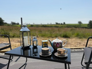
There are endless walks from the doorstep. Head off in a different direction each day and enjoy beautiful views, mature trees, wildflowers and blossoming old cherry trees. The Two Moors Way runs the length of Devon, through the National Parks of Dartmoor to the South and Exmoor in the North. It has a rich tapestry of moorland, rolling countryside and coastline.
Walking the Two Moors Way people experience the peace and tranquillity of the expansive landscape of the wild moors and remains from the Iron and Bronze ages, as well as disused shafts and buildings from its more recent mining past. Even when the moors give way to fields and farmland the views are rarely spoilt by human touches. The walk is challenging through undulating farmland and deep wooded valleys.
There is a wide array of wildlife to be spotted including the famous wild ponies and red deer which roam this stunning landscape. There is some debate about the exact distance of the Two Moors Way, as each guidebook seems to have a different figure, but it is around 100 miles (160km) in total.
Ivybridge (0 miles / 0 km)
The Two Moors Way starts from the bustling little town of Ivybridge.
A short walk from the town centre and you will find yourself in wild, open moorland, with little sign of recent human activities for the next 12 miles, until you reach Scorriton!
The route initially follows a disused tram track and Bronze Age remains and former mining activities litter the route before the track is replaced by pathless, boggy grounds, however you are rewarded with extensive views to Torbay.

Widecombe-in-the-Moor (22 miles / 35km)
Widecombe-in-the-Moor has a number of tea rooms and places to stop.
Bronze Age burial mounts litter its length as it straddles the ridge on Hamel Down, including the well-preserved Bronze Age enclosure of Grimspound. Past Bennett's Cross, there are more disused mine workings, a reminder of Devon's mining past. The path passes for a while alongside Fernworthy Forest, and Chagford Common before weaving through several small woodlands and along the River Teign.
Chagford (31 miles / 50km)
Not far off the route of the Two Moors Way, is Chagford, a lovely small town that enjoys a range of traditional stores, independent tea shops and restaurants.
It boasts a large number of well-preserved old buildings, some of which date back to the 15th century. The Two Moors Way follows the River Teign to Castle Drogo, perched above the valley with great views across Dartmoor. This impressive medieval looking castle was actually built in the 1910s and 1920s.
Drewsteignton (35.5 miles / 57km)
Drewsteignton is another pretty village, with thatched cottages and a parish church, which dates back to 15th century.
Just north of Drewsteignton, on the edge of Dartmoor National Park, is an impressive memorial stone to Joe Turner who set up the Two Moors Way.
Colebrooke (44 miles / 71km)
A short distance from the route, Colebrooke has a 14-15th century church with some interesting carvings.
There are great views towards the northern parts of Dartmoor.
Witheridge (61 miles / 98km)
Witheridge is just over the half way point of the Two Moors Way. Walking through the centre of Witheridge with its rich heritage of historical buildings, it is easy to believe that this was once a busy, thriving market town.
From Witheridge, the Two Moors Way joins the Little Dart River before continuing on the road, which, being on high ground does compensate by offering extensive views to both the south and the north, taking in Dartmoor, Knowstone Moor and Hares Down.
Knowstone (69 miles/107km)
The little village of Knowstone with chocolate-box, thatched cottages, narrow streets and high hedges.
The route passes through fields and woodlands. North of West Anstey is the second half of the memorial boulder to Joe Turner. You enter Exmoor National Park and farmland gradually gives way to commons and moorland.
Hawkridge (76 miles / 118km)
North of Hawkridge, the Two Moors Way offers two options. The first approaches Withypool through predominantly wooded river valley alongside the River Barle.
The route passes through Tarr Steps, where an impressive medieval clapper bridge, consisting of 17 flat stones, spanning over 55 feet across the river. Unsurprisingly, it is a well-known beauty spot, popular with families and walkers at the weekends. The second option is more direct and takes you across higher grounds along Withypool Hill with great views across the moors before dropping down to Withypool.
Withypool (82 miles / 131km)
Withypool is a pretty village, unspoilt by modern development with its colourful cottages and riverside setting.
A six arch stone bridge spans the River Barle. A tea shop, adjacent a quaint Olden World petrol pumps, provides welcome refreshment for hungry walkers. Climbing out of Withypool, the Two Moors Way takes you over the moor with tremendous views over Sherdon Water.
Simonsbath (89 miles / 142km)
Simonsbath is one of the remotest villages in the Exmoor National Park. The route climbs up through woodlands before crossing over Dure Down to enjoy wide ranging views.
It drops down briefly into a river valley before emerging back up again and along Cheriton Ridge. As the route climbs out of the woods, you are greeted with glorious views of the sea and high cliffs before a long, steady descent to Lynmouth.
Lynmouth (100 miles/160km)
The Two Moors Way ends in Lynmouth and greets you with its quaint harbour.
It has a funicular railway which links it with Lynton at the top of the cliff, from where the Valley of Rocks, and the cute feral goats, which roam this rugged terrain, are just a short distance away.